
Topografische kaart Farsala
Interactieve kaart
Klik op de kaart om de hoogte weer te geven.
Farsala
The Pharsalos of the historic era was built over a hillside of the Narthacius mountains at an elevation of some 160 m, where modern Farsala stands. It was one of the main cities in Thessaly and was the capital of the Phthian tetrarch. It was also a polis (city-state).
Over deze kaart
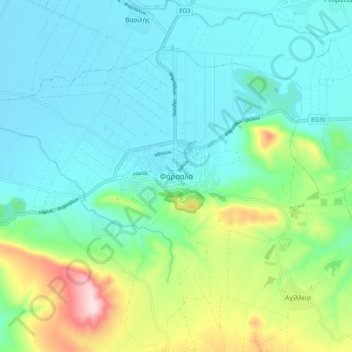
Naam: Topografische kaart Farsala, hoogte, reliëf.
Gemiddelde hoogte: 215 m
Minimale hoogte: 122 m
Maximale hoogte: 523 m