Geolokaliseren

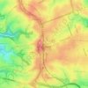
Topografische kaart Mount Wombat

Klik op de kaart om de hoogte weer te geven.

Over deze kaart

Naam: Topografische kaart Mount Wombat, hoogte, reliëf.

Locatie: Mount Wombat, Greater Hume Shire Council, New South Wales, Australia (-35.94066 147.62318 -35.94056 147.62328)

Gemiddelde hoogte: 453 m

Minimale hoogte: 208 m

Maximale hoogte: 884 m

Andere topografische kaarten

Klik op een kaart om zijn topografie, zijn hoogte en zijn reliëf te bekijken.
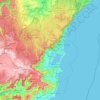
Sydney

Australia > New South Wales

Sydney's topography is characterized by a diverse landscape that seamlessly blends coastal features with inland plateaus. The city is divided into two primary regions: the relatively flat Cumberland Plain to the south and west of Sydney Harbour, and the elevated Hornsby Plateau to the north. The Cumberland…

Gemiddelde hoogte: 51 m
Bowral

Australia > New South Wales

Gemiddelde hoogte: 690 m

Orange

Australia > New South Wales

Orange is a city in the Central Tablelands region of New South Wales, Australia. It is 254 km (158 mi) west of the state capital, Sydney [206 km (128 mi) on a great circle], at an altitude of 862 metres (2,828 ft). Orange had an estimated urban population of 40,493 as of June 2018 making the city a significant…

Gemiddelde hoogte: 852 m
Glen Innes

Australia > New South Wales

Gemiddelde hoogte: 1.083 m

Wauchope

Australia > New South Wales

Gemiddelde hoogte: 32 m

Randwick

Australia > New South Wales > Sydney

Gemiddelde hoogte: 44 m

Rouse Hill

Australia > New South Wales > Sydney

Gemiddelde hoogte: 51 m

Delegate

Australia > New South Wales

Gemiddelde hoogte: 841 m

Newcastle

Australia > New South Wales > Newcastle

Gemiddelde hoogte: 5 m

Byron Bay

Australia > New South Wales

Byron Bay, located in northeastern New South Wales, Australia, is characterized by diverse topography shaped by its geological history. The town is part of the erosion caldera of the ancient Tweed Volcano, which erupted approximately 23 million years ago, resulting in the rich volcanic soils that define the…

Gemiddelde hoogte: 7 m
Lower North Shore

Australia > New South Wales > Sydney

Gemiddelde hoogte: 45 m

Mascot

Australia > New South Wales > Sydney

Gemiddelde hoogte: 8 m

Yass

Australia > New South Wales

Yass is located 280 km south-west of Sydney, on the Hume Highway. The Yass River, which is a tributary of the Murrumbidgee River, flows through the town. Yass is 59 km from Canberra; lying at an elevation of 505 m AMSL.

Gemiddelde hoogte: 533 m
Woolgoolga

Australia > New South Wales

Gemiddelde hoogte: 29 m

Lochiel

Australia > New South Wales

Gemiddelde hoogte: 135 m

Parramatta

Australia > New South Wales

Gemiddelde hoogte: 22 m

Goulburn

Australia > New South Wales

Owing to its elevation, Goulburn has an oceanic climate (Cfb) with warm summers and cool winters; with a high diurnal range. Its climate is variable much of the year, though generally dry with maximum temperatures ranging from 11.8 °C (53.2 °F) in July to 28.3 °C (82.9 °F) in January. Rainfall is…

Gemiddelde hoogte: 666 m
Taree

Australia > New South Wales

Gemiddelde hoogte: 17 m

Bundeena

Australia > New South Wales

Gemiddelde hoogte: 20 m

Lismore

Australia > New South Wales

Gemiddelde hoogte: 23 m

Blue Mountains

Australia > New South Wales

A sandstone plateau dominated by a landscape of endless eucalyptus forests, the Blue Mountains are located at the top of a 470-million-year-old quartzite. In the Permian period, a shallow sea covered the region, when rivers brought shales, siltstones and mudstones. Then during the Mesozoic period, rivers…

Gemiddelde hoogte: 566 m
Blackheath

Australia > New South Wales

Blackheath (postcode: 2785) is an Australian town located near the highest point of the Blue Mountains, between Katoomba and Mount Victoria in New South Wales. The town's altitude is about 1,065 metres (3,494 ft) AHD  and it is located about 120 kilometres (75 mi) west north-west of Sydney, 11 kilometres…

Gemiddelde hoogte: 893 m
Mudgee

Australia > New South Wales

Gemiddelde hoogte: 535 m

Wentworth Falls

Australia > New South Wales > Sydney

Wentworth Falls (postcode: 2782) is a town in the Blue Mountains region of New South Wales, situated approximately 100 kilometres (62 mi) west of the Sydney central business district, and about 8 kilometres (5.0 mi) east of Katoomba, Australia on the Great Western Highway, with a Wentworth Falls railway…

Gemiddelde hoogte: 708 m
Carrington

Australia > New South Wales > Newcastle

Gemiddelde hoogte: 3 m

Black Springs

Australia > New South Wales

Gemiddelde hoogte: 1.157 m

Woombah

Australia > New South Wales

Gemiddelde hoogte: 14 m

Dolls Point

Australia > New South Wales > Sydney

Gemiddelde hoogte: 3 m

Boxers Creek

Australia > New South Wales

Gemiddelde hoogte: 689 m

Albury

Australia > New South Wales > Albury

Gemiddelde hoogte: 183 m

Scotts Head

Australia > New South Wales

Gemiddelde hoogte: 5 m

Barrington Tops

Australia > New South Wales

Gemiddelde hoogte: 1.107 m

Singleton Council

Australia > New South Wales

Gemiddelde hoogte: 238 m

Port Macquarie

Australia > New South Wales

Gemiddelde hoogte: 5 m

Moree

Australia > New South Wales

Gemiddelde hoogte: 216 m

Kyogle Council

Australia > New South Wales

Gemiddelde hoogte: 315 m

Gulmarrad

Australia > New South Wales

Gemiddelde hoogte: 10 m

Williamtown

Australia > New South Wales

Gemiddelde hoogte: 5 m

Illawarra

Australia > New South Wales

Gemiddelde hoogte: 234 m

Banora Point

Australia > New South Wales

Gemiddelde hoogte: 17 m

Kiama

Australia > New South Wales

Gemiddelde hoogte: 29 m

Walcha

Australia > New South Wales

Gemiddelde hoogte: 956 m

North Rocks

Australia > New South Wales

Gemiddelde hoogte: 80 m

Belmont

Australia > New South Wales

Gemiddelde hoogte: 14 m

Bocoble

Australia > New South Wales

Gemiddelde hoogte: 832 m

Wootton

Australia > New South Wales

Gemiddelde hoogte: 102 m

Ashford

Australia > New South Wales

Gemiddelde hoogte: 492 m

Caffreys Flat

Australia > New South Wales

Gemiddelde hoogte: 250 m

Lismore Heights

Australia > New South Wales

Gemiddelde hoogte: 48 m

Geneva

Australia > New South Wales

Gemiddelde hoogte: 95 m

Bondi State Forest

Australia > New South Wales

Gemiddelde hoogte: 711 m

Griffith

Australia > New South Wales

Gemiddelde hoogte: 131 m

Wingham

Australia > New South Wales

Gemiddelde hoogte: 47 m

Moruya

Australia > New South Wales

Gemiddelde hoogte: 37 m

Calderwood

Australia > New South Wales

Gemiddelde hoogte: 100 m

Bilpin

Australia > New South Wales

Gemiddelde hoogte: 527 m

Bossley Park

Australia > New South Wales

Gemiddelde hoogte: 55 m

Skennars Head

Australia > New South Wales

Gemiddelde hoogte: 8 m

Marrickville

Australia > New South Wales > Sydney

Gemiddelde hoogte: 17 m

Redhead

Australia > New South Wales > Newcastle

Gemiddelde hoogte: 30 m

New England National Park

Australia > New South Wales

The park lies within the Eastern Australian temperate forests ecoregion. It is noted for the wide variety of plant and animal species. The diverse vegetation in the park includes sub-tropical, warm temperate and cool temperate rainforest in the higher altitudes. There are also areas of sclerophyll forest,…

Gemiddelde hoogte: 559 m

Carcoar

Australia > New South Wales

Gemiddelde hoogte: 818 m

Knockrow

Australia > New South Wales

Gemiddelde hoogte: 54 m

Cooma

Australia > New South Wales

Gemiddelde hoogte: 869 m

Stroud

Australia > New South Wales

Gemiddelde hoogte: 159 m

Georges River

Australia > New South Wales

Gemiddelde hoogte: 120 m

Jindera

Australia > New South Wales

Gemiddelde hoogte: 272 m

Diehard

Australia > New South Wales

Gemiddelde hoogte: 816 m

Mandurama

Australia > New South Wales

Gemiddelde hoogte: 742 m

Moruya Heads

Australia > New South Wales

Gemiddelde hoogte: 9 m

Mount Victoria

Australia > New South Wales

Mount Victoria (postcode: 2786) is a small township in the Blue Mountains of New South Wales, Australia. Mount Victoria is geographically the western most village and suburb of Greater Sydney on the great western highway in the City of Blue Mountains, located about 120 kilometres (75 mi) west-northwest by road…

Gemiddelde hoogte: 901 m
St Georges Basin

Australia > New South Wales

Gemiddelde hoogte: 18 m

Bawley Point

Australia > New South Wales

Gemiddelde hoogte: 17 m

Iluka

Australia > New South Wales

Gemiddelde hoogte: 2 m

Alstonville

Australia > New South Wales

Gemiddelde hoogte: 131 m

Terrigal

Australia > New South Wales

Gemiddelde hoogte: 13 m

Leichhardt

Australia > New South Wales > Sydney

Gemiddelde hoogte: 22 m

Lindfield

Australia > New South Wales > Sydney

Gemiddelde hoogte: 79 m

Chatswood

Australia > New South Wales

Gemiddelde hoogte: 81 m

Gloucester

Australia > New South Wales > Gloucester

Gemiddelde hoogte: 104 m

Rust jezelf uit voor je volgende avontuur:

🧭Wandelkompassen - Betrouwbare kompassen voor nauwkeurige navigatie in de natuur
🥾Wandelschoenen Dames - Lichte en stabiele wandelschoenen voor lange wandeltochten
⛺Kampeertenten - Lichtgewicht tenten voor trektochten in de natuur
📘Trekking Gidsen - Praktische gidsen voor meerdaagse tochten
🍳Camping Kooksets - Compacte potten en pannen voor outdoor maaltijden

Als Amazon-partner verdient deze site een commissie op in aanmerking komende aankopen, zonder extra kosten voor jou.