
Topografische kaart Swanston
Interactieve kaart
Klik op de kaart om de hoogte weer te geven.
Over deze kaart
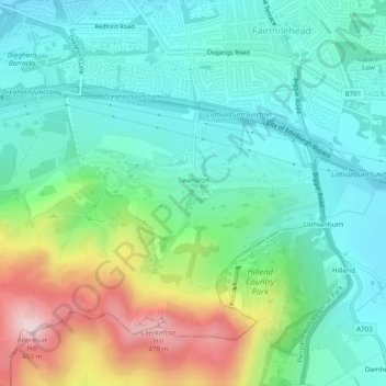
Naam: Topografische kaart Swanston, hoogte, reliëf.
Locatie: Swanston, City of Edinburgh, Scotland, United Kingdom (55.88885 -3.22248 55.89567 -3.21329)
Gemiddelde hoogte: 232 m
Minimale hoogte: 130 m
Maximale hoogte: 490 m
The area was traditionally seen as two farm estates: Easter Swanston owned by the Ross family; and Wester Swanston owned by the Foulis family. The two were united in 1749 when the Trotters of Mortonhall (who had bought Wester Swanston in 1670) also acquired Easter Swanston. The Trotter family planted the T-Wood to the south of the village. This is actually cruciform in plan, but due to local topography appears as a T (for Trotter) from the four compass points. It memorialises a family member lost in battle.