Topografische kaart Garvagh/Arigna ED
Interactieve kaart
Klik op de kaart om de hoogte weer te geven.
Over deze kaart
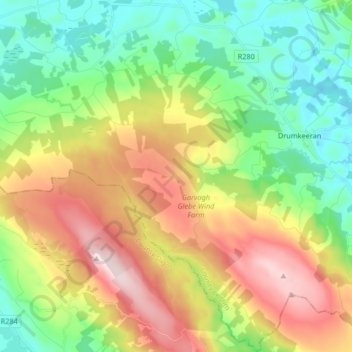
Naam: Topografische kaart Garvagh/Arigna ED, hoogte, reliëf.
Gemiddelde hoogte: 201 m
Minimale hoogte: 49 m
Maximale hoogte: 442 m

Klik op de kaart om de hoogte weer te geven.
Naam: Topografische kaart Garvagh/Arigna ED, hoogte, reliëf.
Gemiddelde hoogte: 201 m
Minimale hoogte: 49 m
Maximale hoogte: 442 m