

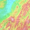
Topografische kaart Pfutsero
Klik op de kaart om de hoogte weer te geven.
Over deze kaart

Naam: Topografische kaart Pfutsero, hoogte, reliëf.
Locatie: Pfutsero, Phek, Nagaland, 797107, India (25.50689 94.23659 25.61630 94.36586)
Gemiddelde hoogte: 1.720 m
Minimale hoogte: 941 m
Maximale hoogte: 2.534 m
Andere topografische kaarten
Klik op een kaart om zijn topografie, zijn hoogte en zijn reliëf te bekijken.
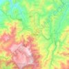
Kohima
India > Nagaland > Kohima Sadar
Kohima (/koʊˈhiːmə/ ; Angami Naga: Kewhira (IPA: [ˈkɛʍɪɻə]) is the capital of the Indian state of Nagaland. With a resident population of almost 100,000, it is the second largest city in the state. Kohima constitutes both a district and a municipality. The municipality covers 20 km2 (7.7 sq mi). The…
Gemiddelde hoogte: 1.425 m








Kohima
India > Nagaland > Kohima Sadar
Kohima (/koʊˈhiːmə/ ; Angami Naga: Kewhira (IPA: [ˈkɛʍɪɻə])) is the capital of the North East Indian state of Nagaland. With a resident population of almost 100,000, it is the second largest city in the state. Kohima constitutes both a district and a municipality. The municipality covers 20 km2 (7.7…
Gemiddelde hoogte: 1.425 m
Kohima
India > Nagaland > Kohima Sadar
Kohima district is the land of the Angami Naga and Rengma Naga tribe. It is situated in the foothills of Japfu range located south of Kohima District (25°40′N 94°07′E / 25.67°N 94.12°E / 25.67; 94.12) and has an average elevation of 1,261 metres (4137 feet).
Gemiddelde hoogte: 1.425 m


