
Topografische kaart Hillsboro
Interactieve kaart
Klik op de kaart om de hoogte weer te geven.
Over deze kaart
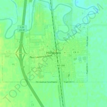
Naam: Topografische kaart Hillsboro, hoogte, reliëf.
Locatie: Hillsboro, Traill County, North Dakota, United States (47.39647 -97.08123 47.41088 -97.04936)
Gemiddelde hoogte: 276 m
Minimale hoogte: 269 m
Maximale hoogte: 281 m
Andere topografische kaarten
Klik op een kaart om zijn topografie, zijn hoogte en zijn reliëf te bekijken.
Portland
United States > North Dakota > Traill County
Portland, Traill County, North Dakota, 58274, United States
Gemiddelde hoogte: 300 m
Hatton
United States > North Dakota > Traill County
Hatton, Traill County, North Dakota, United States
Gemiddelde hoogte: 329 m
Mayville
United States > North Dakota > Traill County
Mayville, Traill County, North Dakota, 58257, United States
Gemiddelde hoogte: 296 m