
Topografische kaart Kunigal
Interactieve kaart
Klik op de kaart om de hoogte weer te geven.
Kunigal
Kunigal is located at 13°01′N 77°02′E / 13.02°N 77.03°E / 13.02; 77.03. It has an average elevation of 773 metres (2536 feet). It is situated on the National Highway 75 (India) connecting Bengaluru and Mangaluru and State Highway 33 (Karnataka) connecting Tumakuru and Madduru. Kunigal is situated 70 kilometres west of Bengaluru and 115 kilometres north of Mysuru. Recently opened Hassan-Bangalore railway line transverses through Kunigal.
Over deze kaart
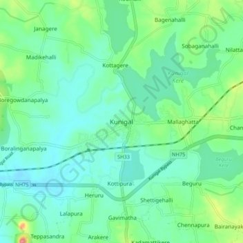
Naam: Topografische kaart Kunigal, hoogte, reliëf.
Locatie: Kunigal, Kunigal taluk, Tumakuru, Karnataka, 572130, India (12.98602 76.98227 13.06602 77.06227)
Gemiddelde hoogte: 775 m
Minimale hoogte: 751 m
Maximale hoogte: 850 m