
Topografische kaart Westwood
Interactieve kaart
Klik op de kaart om de hoogte weer te geven.
Westwood
Westwood is a census-designated place in Boyd County, Kentucky, United States. The population was 4,387 at the 2020 census. A suburb of Ashland, the two areas are closely affiliated, sharing a ZIP code and bus system. Westwood is located on a flat to hilly elevation just west of the Ohio River. The flat hilltop is unusual to eastern Kentucky and was created by the preglacial Teays River which existed in ancient times and flowed in the opposite direction of the Ohio River. Westwood is part of the Huntington–Ashland metropolitan area.
Over deze kaart
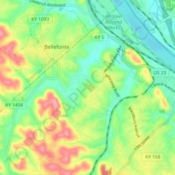
Naam: Topografische kaart Westwood, hoogte, reliëf.
Locatie: Westwood, Fairview, Boyd County, Kentucky, United States (38.45635 -82.70721 38.50581 -82.65651)
Gemiddelde hoogte: 192 m
Minimale hoogte: 154 m
Maximale hoogte: 252 m