
Topografische kaart Albulapass
Interactieve kaart
Klik op de kaart om de hoogte weer te geven.
Albulapass
The Albula Pass is an important axis from central Graubünden to Engadin. It is traversed by a paved road from Thusis to La Punt, via Bergün. It is also traversed by the Albula Railway, although at a lower elevation through the Albula Tunnel (1,820 m), from Thusis to Bever, also via Bergün.
Over deze kaart
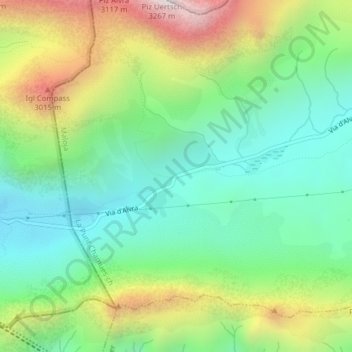
Naam: Topografische kaart Albulapass, hoogte, reliëf.
Gemiddelde hoogte: 2.560 m
Minimale hoogte: 2.202 m
Maximale hoogte: 3.228 m