
Topografische kaart El Ouricia
Interactieve kaart
Klik op de kaart om de hoogte weer te geven.
Over deze kaart
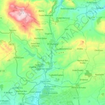
Naam: Topografische kaart El Ouricia, hoogte, reliëf.
Locatie: El Ouricia, Ain Arnat District, Setif, Algeria (36.21637 5.28075 36.32506 5.47877)
Gemiddelde hoogte: 1.179 m
Minimale hoogte: 959 m
Maximale hoogte: 1.733 m