
Topografische kaart Bella Vista
Interactieve kaart
Klik op de kaart om de hoogte weer te geven.
Bella Vista
The city of Bella Vista is located on the Springfield Plateau of the Ozark Mountains. Oak/hickory forests, along with valleys, creeks, and steep rises, characterize the city's topography. Bella Vista is located north of Bentonville and Rogers and is the northernmost Arkansas city in the Standard Metropolitan Statistical Area (which includes McDonald County, Missouri). The city has been experiencing a population and building boom in recent years, as indicated by a 60% growth in population between the 2000 and 2010 censuses.
Over deze kaart
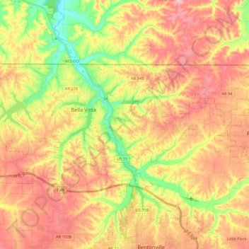
Naam: Topografische kaart Bella Vista, hoogte, reliëf.
Gemiddelde hoogte: 374 m
Minimale hoogte: 283 m
Maximale hoogte: 448 m