
Topografische kaart Hood River
Interactieve kaart
Klik op de kaart om de hoogte weer te geven.
Over deze kaart
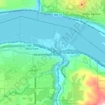
Naam: Topografische kaart Hood River, hoogte, reliëf.
Gemiddelde hoogte: 112 m
Minimale hoogte: 14 m
Maximale hoogte: 504 m
Temperatures for the year as a whole are slightly cooler than most other low-elevation towns in the region, especially at night due to air drainage off the surrounding mountains. As a rule of thumb, Hood River temperatures are similar to those of Portland in the summer, but more like The Dalles in the winter.