
Topografische kaart Saldanha Bay Ward 5
Interactieve kaart
Klik op de kaart om de hoogte weer te geven.
Over deze kaart
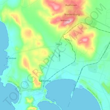
Naam: Topografische kaart Saldanha Bay Ward 5, hoogte, reliëf.
Gemiddelde hoogte: 43 m
Minimale hoogte: -2 m
Maximale hoogte: 182 m
Andere topografische kaarten
Klik op een kaart om zijn topografie, zijn hoogte en zijn reliëf te bekijken.
Saldanha Bay Local Municipality
Zuid-Afrika > Western Cape > Saldanha Bay Local Municipality
Saldanha Bay Local Municipality, West Coast District Municipality, Western Cape, Zuid-Afrika
Gemiddelde hoogte: 60 m