

Topografische kaart Matera
Klik op de kaart om de hoogte weer te geven.
Matera
The Sassi consist of around twelve levels spanning the height of 380 m, connected by a network of paths, stairways, and courtyards (vicinati). The medieval city clinging on to the edge of the canyon for its defence is invisible from the western approach. The tripartite urban structure of Civita and the two Sassi, relatively isolated from each other, survived until the 16th century, when the centre of public life moved outside the walls to the Piazza Sedile in the open plain (the Piano) to the west, followed by the shift of the elite residences to the Piano from the 17th century onwards. By the end of the 18th century, a physical class boundary separated the overcrowded Sassi of the peasants from the new spatial order of their social superiors in the Piano, and geographical elevation came to coincide with status more overtly than before, to the point where the two communities no longer interacted socially.
Over deze kaart
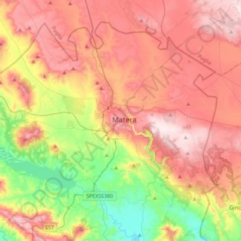
Naam: Topografische kaart Matera, hoogte, reliëf.
Locatie: Matera, Basilicata, 75100, Italy (40.56741 16.41278 40.76453 16.72908)
Gemiddelde hoogte: 293 m
Minimale hoogte: 45 m
Maximale hoogte: 519 m