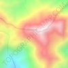
Topografische kaart Kanimbla
Klik op de kaart om de hoogte weer te geven.
Kanimbla
The suburb straddles the upper reaches of Moody's Creek and is bordered to the north by the Cairns Western Arterial Road (state route 91). The main road that goes through Kanimbla is Ramsey Drive. Along the middle of the northern boundary is Whites Gap. In the south west elevations reach heights greater than 500 m towards the summit of Mooroobool Peak.
Over deze kaart

Naam: Topografische kaart Kanimbla, hoogte, reliëf.
Gemiddelde hoogte: 121 m
Minimale hoogte: 5 m
Maximale hoogte: 592 m
Andere topografische kaarten
Klik op een kaart om zijn topografie, zijn hoogte en zijn reliëf te bekijken.