
Topografische kaart beleshwar
Klik op de kaart om de hoogte weer te geven.
Over deze kaart
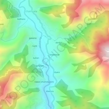
Naam: Topografische kaart beleshwar, hoogte, reliëf.
Locatie: beleshwar, Ghansali, Tehri Garhwal, Uttarakhand, 249181, India (30.44392 78.61784 30.48392 78.65784)
Gemiddelde hoogte: 1.225 m
Minimale hoogte: 860 m
Maximale hoogte: 1.852 m