
Topografische kaart Piz Vadret
Interactieve kaart
Klik op de kaart om de hoogte weer te geven.
Piz Vadret
Piz Vadret is a mountain of the Albula Alps, in Graubünden. With an altitude of 3,229 metres above sea level, Piz Vadret is the highest mountain of the Albula Alps north of Piz Kesch. At the base of the north face lies a glacier named Vadret da Grialetsch. The closest locality is Brail, in the Engadin.
Over deze kaart
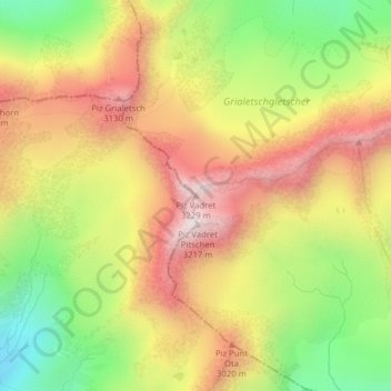
Naam: Topografische kaart Piz Vadret, hoogte, reliëf.
Gemiddelde hoogte: 2.824 m
Minimale hoogte: 2.426 m
Maximale hoogte: 3.190 m