
Topografische kaart Château d'Ars
Interactieve kaart
Klik op de kaart om de hoogte weer te geven.
Over deze kaart
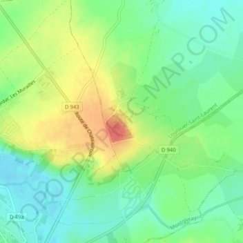
Naam: Topografische kaart Château d'Ars, hoogte, reliëf.
Gemiddelde hoogte: 219 m
Minimale hoogte: 196 m
Maximale hoogte: 254 m
Andere topografische kaarten
Klik op een kaart om zijn topografie, zijn hoogte en zijn reliëf te bekijken.
Le Montoire
France > Centre-Val de Loire > Nohant-Vic
Le Montoire, Nohant-Vic, La Châtre, Indre, Centre-Val de Loire, France métropolitaine, 36400, France
Gemiddelde hoogte: 200 m