
Topografische kaart Pinedale
Interactieve kaart
Klik op de kaart om de hoogte weer te geven.
Over deze kaart
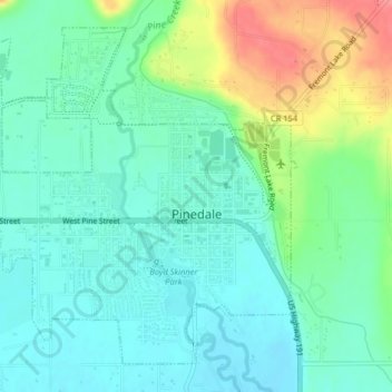
Naam: Topografische kaart Pinedale, hoogte, reliëf.
Gemiddelde hoogte: 2.199 m
Minimale hoogte: 2.177 m
Maximale hoogte: 2.253 m
Pinedale is located at 42°51′58″N 109°51′53″W / 42.86611°N 109.86472°W / 42.86611; -109.86472 (42.866162, −109.864622) and sits at an elevation of 7,175 feet above sea level. According to the United States Census Bureau, the town has a total area of 2.15 square miles (5.57 km2), all of it land.