Geolokaliseren
👉 Easily get elevation data in JSON, GeoTIFF and KML formats using Elevation API
Bedankt voor het steunen van deze site ❤️
Doe een donatie

Topografische kaart Aluva

Klik op de kaart om de hoogte weer te geven.

👉 Easily get elevation data in JSON, GeoTIFF and KML formats using Elevation API
Bedankt voor het steunen van deze site ❤️
Doe een donatie

Rust jezelf uit voor je volgende avontuur:

Als Amazon-partner verdient deze site een commissie op in aanmerking komende aankopen, zonder extra kosten voor jou.

Aluva

Aluva Railway Station (IR Code: AWY) is a grade-A railway station in Kerala, and is the third busiest railway station in Kochi after Ernakulam Junction railway station and Ernakulam Town railway station. All passenger and express trains bound to southern Kerala have a stop at it. People travelling from the Idukki district must also use either the Aluva railway station or the Tripunithura railway station for all their train journeys, since the Idukki district's topography cannot accommodate a railway station. There are no trains with routes that start or end at the Aluva Railway Station. Aluva Railway Station is situated at the Railway Station Road junction near the KSRTC stand. The KSRTC stand hosts buses from Ernakulam and City Low Floor buses (with and without A/C) in order to connect the majority of the places in Kerala.

Wikipedia (CC-BY-SA 3.0)

👉 Easily get elevation data in JSON, GeoTIFF and KML formats using Elevation API
Bedankt voor het steunen van deze site ❤️
Doe een donatie

Rust jezelf uit voor je volgende avontuur:

Als Amazon-partner verdient deze site een commissie op in aanmerking komende aankopen, zonder extra kosten voor jou.

Over deze kaart

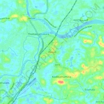
Naam: Topografische kaart Aluva, hoogte, reliëf.

Locatie: Aluva, Ernakulam, Kerala, 683101, India (10.06777 76.31685 10.14777 76.39685)

Gemiddelde hoogte: 11 m

Minimale hoogte: -2 m

Maximale hoogte: 52 m

👉 Easily get elevation data in JSON, GeoTIFF and KML formats using Elevation API
Bedankt voor het steunen van deze site ❤️
Doe een donatie

Rust jezelf uit voor je volgende avontuur:

Als Amazon-partner verdient deze site een commissie op in aanmerking komende aankopen, zonder extra kosten voor jou.

Andere topografische kaarten

Klik op een kaart om zijn topografie, zijn hoogte en zijn reliëf te bekijken.

Mookkannoor

India > Kerala > Aluva > Ezhattumugham

Gemiddelde hoogte: 31 m

Thuravoor (Ernakulam)

India > Kerala > Aluva > Thuravoor

Gemiddelde hoogte: 22 m

Rust jezelf uit voor je volgende avontuur:

🗺️Wandelkaarten België - Gedetailleerde wandelkaarten voor Belgische regio’s
🥤Outdoor Drinkflessen - Herbruikbare flessen voor lange wandelingen
Trekking Tenten - Lichte en stevige tenten voor wandelvakanties
🍹Thermosflessen - Warme koffie of thee op de koude toppen
🔋Outdoor Powerbanks - Extra energie voor GPS en smartphones onderweg

Als Amazon-partner verdient deze site een commissie op in aanmerking komende aankopen, zonder extra kosten voor jou.