Topografische kaart Anamudi
Klik op de kaart om de hoogte weer te geven.
Anamudi
Anamudi ("Elephant head", Malayalam: [aːnɐmuɖi]) is a mountain located in Ernakulam district and Idukki district of the Indian state of Kerala. With an elevation of 2,695 m (8,842 ft), it is the highest peak in the Western Ghats and in South India.
Over deze kaart
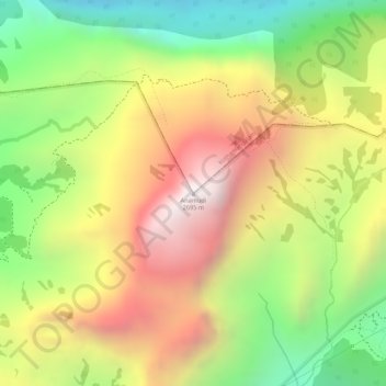
Naam: Topografische kaart Anamudi, hoogte, reliëf.
Locatie: Anamudi, Devikulam, Idukki, Kerala, 685614, India (10.16959 77.06114 10.16969 77.06124)
Gemiddelde hoogte: 2.209 m
Minimale hoogte: 1.703 m
Maximale hoogte: 2.685 m
Andere topografische kaarten
Klik op een kaart om zijn topografie, zijn hoogte en zijn reliëf te bekijken.