

Topografische kaart Billinghay
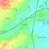
Klik op de kaart om de hoogte weer te geven.
Billinghay
The settlement is mentioned in the Domesday Book. The name originates from a Saxon name for a fishery. The topography in ancient times would have been that of a small settlement on a gravel mound surrounded by marsh which was flooded in winter. After the draining of the fens in the late 18th century the area became rich agricultural land as it is today.
Over deze kaart
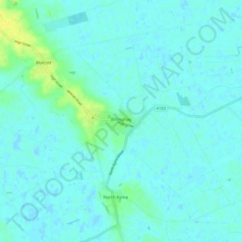
Naam: Topografische kaart Billinghay, hoogte, reliëf.
Gemiddelde hoogte: 4 m
Minimale hoogte: -1 m
Maximale hoogte: 19 m
Andere topografische kaarten
Klik op een kaart om zijn topografie, zijn hoogte en zijn reliëf te bekijken.


Threekingham
United Kingdom > England > Lincolnshire > North Kesteven > Threekingham
Gemiddelde hoogte: 30 m
Helpringham
United Kingdom > England > Lincolnshire > North Kesteven > Helpringham
Gemiddelde hoogte: 8 m
Doddington
United Kingdom > England > Lincolnshire > North Kesteven > Doddington
Gemiddelde hoogte: 19 m
Quarrington
United Kingdom > England > Lincolnshire > North Kesteven
According to the Köppen classification, the British Isles experience a maritime climate characterised by relatively cool summers and mild winters. Lincolnshire's position on the east of the Isles allows for a sunnier and warmer climate relative to the national average, and it is one of the driest counties in…
Gemiddelde hoogte: 21 m



Long Holt Wood
United Kingdom > England > Lincolnshire > North Kesteven > Nocton
Gemiddelde hoogte: 20 m


Three Kings Deer
United Kingdom > England > Lincolnshire > North Kesteven > Threekingham
Gemiddelde hoogte: 24 m