
Topografische kaart Ashland
Interactieve kaart
Klik op de kaart om de hoogte weer te geven.
Over deze kaart
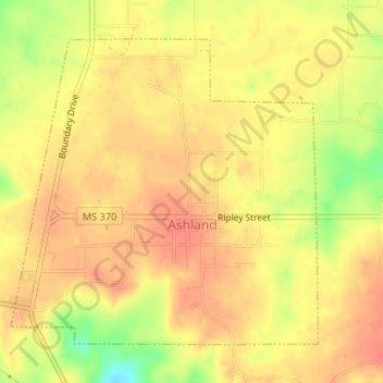
Naam: Topografische kaart Ashland, hoogte, reliëf.
Locatie: Ashland, Benton County, Mississippi, United States (34.82440 -89.19149 34.84594 -89.16512)
Gemiddelde hoogte: 185 m
Minimale hoogte: 148 m
Maximale hoogte: 201 m