
Topografische kaart Sugar Mountain
Interactieve kaart
Klik op de kaart om de hoogte weer te geven.
Sugar Mountain
Sugar Mountain is a mountain in the North Carolina High Country and wholly in the Pisgah National Forest. Its elevation reaches 5,236 feet (1,596 m) and is split along the Eastern Continental Divide, generating feeder streams for the Linville, Elk, and North Toe rivers. On its north slope resides the Village of Sugar Mountain.
Over deze kaart
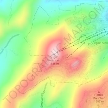
Naam: Topografische kaart Sugar Mountain, hoogte, reliëf.
Gemiddelde hoogte: 1.385 m
Minimale hoogte: 1.211 m
Maximale hoogte: 1.584 m