
Topografische kaart Atata
Interactieve kaart
Klik op de kaart om de hoogte weer te geven.
Over deze kaart
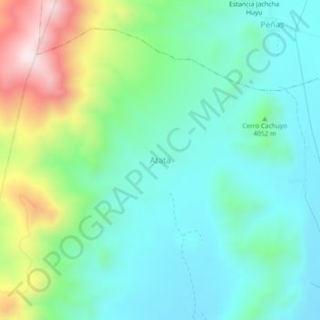
Naam: Topografische kaart Atata, hoogte, reliëf.
Locatie: Atata, Municipio Pazña, Provincia Poopó, Oruro, Bolívia (-18.68269 -66.80593 -18.64269 -66.76593)
Gemiddelde hoogte: 3.982 m
Minimale hoogte: 3.818 m
Maximale hoogte: 4.422 m