
Topografische kaart Asokore-Mampong Municipal District
Interactieve kaart
Klik op de kaart om de hoogte weer te geven.
Over deze kaart
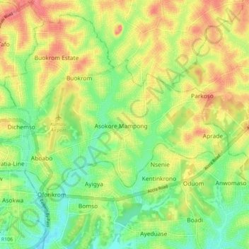
Naam: Topografische kaart Asokore-Mampong Municipal District, hoogte, reliëf.
Locatie: Asokore-Mampong Municipal District, Ashanti (regio), Ghana (6.69013 -1.61800 6.73496 -1.53169)
Gemiddelde hoogte: 274 m
Minimale hoogte: 236 m
Maximale hoogte: 318 m