

Topografische kaart Nyoma
Klik op de kaart om de hoogte weer te geven.
Nyoma
The upgrade expanded the airstrip to a 1,235 acre an airbase capable of supporting fighter jet operations at 13,700 feet (4,200 m) elevation with an expanded 2.7 km (8,900 ft)-long, 46 m (151 ft)-wide runway paved runway along with allied military infrastructure. The supporting infrastructure included ATC complex, hangar, crash bay, watch towers, and accommodation facilities.
Over deze kaart
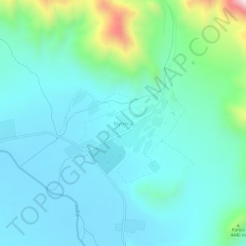
Naam: Topografische kaart Nyoma, hoogte, reliëf.
Locatie: Nyoma, Leh district, Ladakh, 194404, India (33.18548 78.62966 33.22548 78.66966)
Gemiddelde hoogte: 4.260 m
Minimale hoogte: 4.133 m
Maximale hoogte: 4.850 m
Andere topografische kaarten
Klik op een kaart om zijn topografie, zijn hoogte en zijn reliëf te bekijken.
Zanskar
Zanskar covers an area of some 7,000 square kilometres (2,700 sq mi), generally at an elevation between 3,600 and 4,000 m (11,800 and 13,100 ft). It consists of the country lying along the two main branches of the Zanskar River. The first, the Doda River, has its source near the Penzi La 4,400 metres (14,400…
Gemiddelde hoogte: 4.764 m
Nubra
The main road access to Nubra is over Khardung La pass which is open throughout the year. The highest elevation of Khardung La is 5,359 m (17,582 ft), its status as the highest motorable road in the world is no longer accepted by most authorities. An alternative route, opened in 2008, crosses the Wari La from…
Gemiddelde hoogte: 4.978 m
Leh district
Leh is connected to the rest of India by two high-altitude roads both of which are subject to landslides and neither of which are passable in winter when covered by deep snows. The National Highway 1D from Srinagar via Kargil is generally open longer. The Leh-Manali Highway can be troublesome due to very high…
Gemiddelde hoogte: 4.974 m


Kargil district old
Kargil has an average elevation of 2,676 metres (8,780 feet), and is situated along the banks of the Suru River (Indus). The town of Kargil is located 205 km (127 mi) from Srinagar, facing the Northern Areas across the LOC. Like other areas in the Himalayas, Kargil has a temperate climate. Summers are hot with…
Gemiddelde hoogte: 4.214 m

Drang Drung Glacier
India > Ladakh > Zanskar tehsil
The Drang-Drung Glacier is likely to be the largest glacier in Ladakh after the Siachen Glacier in the Karakoram Range, with a maximum length of 23 km (14 mi) at an average elevation of 4,780 m (15,680 ft; 2.97 mi). The glacier lies in the northeastern Himalayan Range known as the Zanskar Range, 142 km (88 mi)…
Gemiddelde hoogte: 5.098 m

Zanskar
Zanskar covers an area of some 7,000 square kilometres (2,700 sq mi), generally at an elevation between 3,600 and 4,000 m (11,800 and 13,100 ft). It consists of the country lying along the two main branches of the Zanskar River. The first, the Doda River, has its source near the Pensi La 4,400 metres (14,400…
Gemiddelde hoogte: 4.764 m
Kargil district old
Kargil has an average elevation of 2,676 metres (8,780 feet), and is situated along the banks of the Suru River (Indus). The town of Kargil is located 205 km (127 mi) from Srinagar, facing the Northern Areas across the LOC. Like other areas in the Himalayas, Kargil has a temperate climate. Summers are hot with…
Gemiddelde hoogte: 4.214 m

Drang Drung Glacier
The Drang-Drung Glacier is likely to be the largest glacier in Ladakh after the Siachen Glacier in the Karakoram Range, with a maximum length of 23 km (14 mi) at an average elevation of 4,780 m (15,680 ft; 2.97 mi). The glacier lies in the northeastern Himalayan Range known as the Zanskar Range, 142 km (88 mi)…
Gemiddelde hoogte: 5.101 m
Nubra district
One of the main draws of Nubra is the Khardongla pass, the highest motorable road at 18,380 feet, along with stunning peaks, glaciers, enchanting valleys, and villages. Diskit and Samstanling Monastery, Panamik thermal spring, two-humped camel ride, white-water rafting, hiking, and relaxing in the sand dunes…
Gemiddelde hoogte: 4.978 m