
Topografische kaart Aberdeen
Interactieve kaart
Klik op de kaart om de hoogte weer te geven.
Over deze kaart
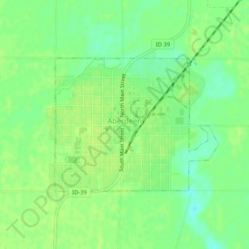
Naam: Topografische kaart Aberdeen, hoogte, reliëf.
Locatie: Aberdeen, Bingham County, Idaho, 83210, United States (42.93691 -112.84870 42.95138 -112.82435)
Gemiddelde hoogte: 1.341 m
Minimale hoogte: 1.332 m
Maximale hoogte: 1.345 m
Aberdeen is located at 42°56′36″N 112°50′22″W / 42.94333°N 112.83944°W / 42.94333; -112.83944 (42.943405, -112.839322), at an elevation of 4,403 feet (1,342 m) above sea level. According to the United States Census Bureau, the city has a total area of 1.03 square miles (2.67 km2), all of it land.
Andere topografische kaarten
Klik op een kaart om zijn topografie, zijn hoogte en zijn reliëf te bekijken.
Blackfoot
United States > Idaho > Bingham County
Blackfoot, Bingham County, Idaho, 83221, United States
Gemiddelde hoogte: 1.371 m
Atomic City
United States > Idaho > Bingham County
Atomic City, Bingham County, Idaho, 83215, United States
Gemiddelde hoogte: 1.533 m
Fort Hall
United States > Idaho > Bingham County
Fort Hall, Bingham County, Idaho, 83203, United States
Gemiddelde hoogte: 1.356 m