
Topografische kaart Gatakers Bay Foreshore Reserve
Interactieve kaart
Klik op de kaart om de hoogte weer te geven.
Over deze kaart
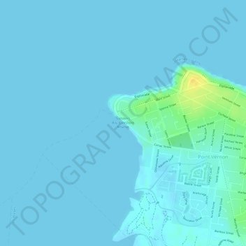
Naam: Topografische kaart Gatakers Bay Foreshore Reserve, hoogte, reliëf.
Gemiddelde hoogte: 3 m
Minimale hoogte: -5 m
Maximale hoogte: 26 m
Andere topografische kaarten
Klik op een kaart om zijn topografie, zijn hoogte en zijn reliëf te bekijken.
Eli Waters
Australia > Queensland > Hervey Bay
Eli Waters, Hervey Bay, Fraser Coast Regional, Queensland, Australia
Gemiddelde hoogte: 3 m
Big Woody Island
Australia > Queensland > Hervey Bay
Big Woody Island, Great Sandy Strait, Hervey Bay, Fraser Coast Regional, Queensland, Australia
Gemiddelde hoogte: 3 m
Dundowran beach
Australia > Queensland > Hervey Bay > Dundowran Beach
Dundowran beach, Dundowran Beach, Hervey Bay, Fraser Coast Regional, Queensland, Australia
Gemiddelde hoogte: 4 m
Craignish
Australia > Queensland > Hervey Bay > Craignish
Craignish, Hervey Bay, Queensland, Australia
Gemiddelde hoogte: 8 m
Quota Park
Australia > Queensland > Hervey Bay
Quota Park, Urangan, Hervey Bay, Queensland, Australia
Gemiddelde hoogte: 3 m
Wanggoolba Creek
Australia > Queensland > Hervey Bay
Wanggoolba Creek, Hervey Bay, Queensland, Australia
Gemiddelde hoogte: 49 m
Lake Birrabeen
Australia > Queensland > Hervey Bay
Lake Birrabeen, Birrabeen Road, Hervey Bay, Queensland, Australia
Gemiddelde hoogte: 118 m
Lake Wabby
Australia > Queensland > Hervey Bay
Lake Wabby, Cornwells Break Road, Hervey Bay, Queensland, Australia
Gemiddelde hoogte: 71 m