
Topografische kaart Wadi Rum desert
Interactieve kaart
Klik op de kaart om de hoogte weer te geven.
Wadi Rum desert
The area is centered on the main valley of Wadi Rum. The highest elevation in Jordan is Jabal Umm ad Dami at 1,840 m (6,040 ft) high (SRTM data states 1854 m), located 30 kilometres south of Wadi Rum village. It was first located by Difallah Ateeg, a Zalabia Bedouin from Rum. On a clear day, it is possible to see the Red Sea and the Saudi border from the top.
Over deze kaart
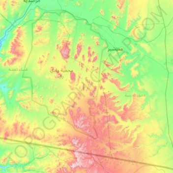
Naam: Topografische kaart Wadi Rum desert, hoogte, reliëf.
Gemiddelde hoogte: 1.041 m
Minimale hoogte: 637 m
Maximale hoogte: 1.831 m