
Topografische kaart Pinyon Pines
Interactieve kaart
Klik op de kaart om de hoogte weer te geven.
Over deze kaart
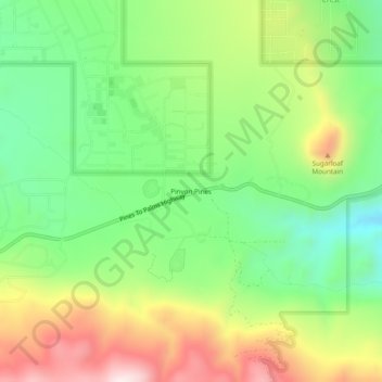
Naam: Topografische kaart Pinyon Pines, hoogte, reliëf.
Gemiddelde hoogte: 1.276 m
Minimale hoogte: 1.040 m
Maximale hoogte: 1.621 m
It is located in a small valley between the San Jacinto Mountains and Santa Rosa Mountains, north of State Route 74. It takes its name from the Pinyon pine (Pinus monophylla) trees native to the area. Pinyon Pines sits at an elevation of approximately 4000 feet.