
Topografische kaart Armadouro
Interactieve kaart
Klik op de kaart om de hoogte weer te geven.
Over deze kaart
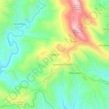
Naam: Topografische kaart Armadouro, hoogte, reliëf.
Locatie: Armadouro, Cabril, Pampilhosa da Serra, Coimbra, Portugal (40.04242 -7.88372 40.08242 -7.84372)
Gemiddelde hoogte: 615 m
Minimale hoogte: 441 m
Maximale hoogte: 924 m