

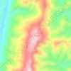
Topografische kaart Serchhip
Klik op de kaart om de hoogte weer te geven.
Serchhip
With an average elevation of 888 metres (2,913 ft), the average annual daily temperature ranges from 15 °C to 27 °C and the rainfall is moderate.
Over deze kaart

Naam: Topografische kaart Serchhip, hoogte, reliëf.
Locatie: Serchhip, Mizoram, India (23.01139 92.68275 23.59990 93.18036)
Gemiddelde hoogte: 734 m
Minimale hoogte: 64 m
Maximale hoogte: 1.864 m
Andere topografische kaarten
Klik op een kaart om zijn topografie, zijn hoogte en zijn reliëf te bekijken.
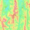
Aizawl
Aizawl has a mild, sub-tropical climate due to its location and elevation. Under the Köppen climate classification, Aizawl features a humid subtropical climate (Cwa). In summer, temperatures are moderately warm, averaging around 20–30 °C (68–86 °F). In winter, daytime temperatures are cooler in…
Gemiddelde hoogte: 556 m




Aizawl
Aizawl (English: /ˈaɪzɔːl/ EYE-zawl; Mizo: [ˈaɪ̯.ˈzɔːl] ), formerly known as Aijal, is the capital city and the most populous city of Mizoram, India. It is also the third largest city in northeast India. It is situated atop a series of ridges, with an average elevation of around 1,132 metres (3,714…
Gemiddelde hoogte: 562 m
Aizawl
Aizawl (English: /ˈaɪzɔːl/ EYE-zawl; Mizo: [ˈaɪ̯.ˈzɔːl] ), formerly known as Aijal, is the capital city and the most populous city of Mizoram, India. It is also the third largest city in northeast India. It is situated atop a series of ridges, with an average elevation of around 1,132 metres (3,714…
Gemiddelde hoogte: 562 m
Aizawl
Aizawl (English: /aɪˈzɔːl/; Mizo: [ˈaɪ̯.ˈzɔːl] ), formerly known as Aijal, is the capital city and the most populous city of Mizoram, India. It is also the third largest city in northeast India, after Guwahati and Agartala. It is situated atop a series of ridges, with an average elevation of around…
Gemiddelde hoogte: 562 m
