
Topografische kaart Cherokee
Interactieve kaart
Klik op de kaart om de hoogte weer te geven.
Over deze kaart
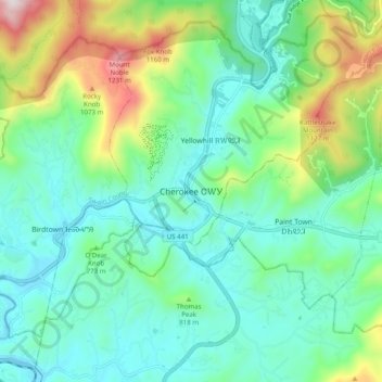
Naam: Topografische kaart Cherokee, hoogte, reliëf.
Gemiddelde hoogte: 746 m
Minimale hoogte: 554 m
Maximale hoogte: 1.306 m
Cherokee and its surrounding Qualla Boundary is in the very mountainous Swain and Jackson counties. The highest elevation is 6,643-foot (2,025 m) Clingman's Dome at the border with Tennessee. Clingman's Dome is the highest point in the Great Smoky Mountains National Park. The Oconaluftee River flows through downtown Cherokee.