
Topografische kaart Brooklyn Bridge Park
Interactieve kaart
Klik op de kaart om de hoogte weer te geven.
Over deze kaart
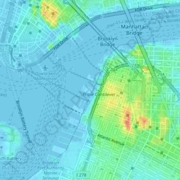
Naam: Topografische kaart Brooklyn Bridge Park, hoogte, reliëf.
Gemiddelde hoogte: 9 m
Minimale hoogte: -6 m
Maximale hoogte: 56 m
Brooklyn Bridge Park spans 85 acres (34 ha) of the East River waterfront in the Brooklyn Heights and Dumbo neighborhoods of Brooklyn. The park is divided into eleven sections: Piers 1 through 6; Fulton Ferry Landing; Brooklyn Bridge Plaza; Empire Fulton Ferry; Main Street; and John Street. Each of these sections features unique topographies, plantings, amenities, and cultural artifacts and installations, and the Brooklyn–Queens Greenway spans the park, as does the Brooklyn Waterfront Greenway.
Andere topografische kaarten
Klik op een kaart om zijn topografie, zijn hoogte en zijn reliëf te bekijken.
Manhattan
United States > New York > New York County > New York
Manhattan, New York County, New York, United States
Gemiddelde hoogte: 16 m
Central Park
United States > New York > New York County > New York
Central Park, New York County, New York, United States
Gemiddelde hoogte: 26 m
Roosevelt Island
United States > New York > New York County > New York
Roosevelt Island, Manhattan, New York County, New York, 10044, United States
Gemiddelde hoogte: 13 m
Battery Park
United States > New York > New York County > New York
Battery Park, Manhattan Community Board 1, Manhattan, New York County, New York, 10004, United States
Gemiddelde hoogte: 3 m
Sara D. Roosevelt Park
United States > New York > New York County > New York
Sara D. Roosevelt Park, Lower East Side, Manhattan, New York County, New York, United States
Gemiddelde hoogte: 14 m
Paley Park
United States > New York > New York County > New York
Paley Park, Midtown East, Manhattan, New York County, New York, 10022, United States
Gemiddelde hoogte: 24 m
Liberty Island
United States > New York > New York County > New York
Liberty Island, Manhattan Community Board 1, Manhattan, New York County, New York, Hudson County, New York, United States
Gemiddelde hoogte: 0 m
Fort Tryon Park
United States > New York > New York County > New York
Fort Tryon Park, Manhattan, New York County, New York, United States
Gemiddelde hoogte: 20 m
Morningside Park
United States > New York > New York County > New York
Morningside Park, Morningside Heights, Manhattan, New York County, New York, United States
Gemiddelde hoogte: 20 m
Bennett Park
United States > New York > New York County > New York
Bennett Park, Hudson Heights, Manhattan, New York County, New York, United States
Gemiddelde hoogte: 24 m
Hunter’s Point South Waterfront Park
United States > New York > New York County > New York
Hunter’s Point South Waterfront Park, Manhattan Community Board 6, Manhattan, New York County, New York, United States
Gemiddelde hoogte: 5 m
Teardrop Park
United States > New York > New York County > New York
Teardrop Park, Manhattan Community Board 1, Manhattan, New York County, New York, United States
Gemiddelde hoogte: 6 m
Governors Island
United States > New York > New York County > New York
Governors Island, Manhattan, New York County, New York, United States
Gemiddelde hoogte: 1 m
Sherman Square
United States > New York > New York County > New York
Sherman Square, Manhattan Community Board 7, Manhattan, New York County, New York, United States
Gemiddelde hoogte: 22 m
Highbridge Park
United States > New York > New York County > New York
Highbridge Park, Manhattan, New York County, New York, United States
Gemiddelde hoogte: 30 m