
Topografische kaart Davis
Interactieve kaart
Klik op de kaart om de hoogte weer te geven.
Davis
Davis lies in the Sacramento Valley, the northern portion of the Central Valley, in Northern California, at an elevation of about 52 feet (16 m) above sea level.
Over deze kaart
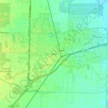
Naam: Topografische kaart Davis, hoogte, reliëf.
Locatie: Davis, Yolo County, California, 95616, United States (38.50538 -121.78458 38.58538 -121.70458)
Gemiddelde hoogte: 15 m
Minimale hoogte: 7 m
Maximale hoogte: 23 m