
Topografische kaart Manalapan Township
Interactieve kaart
Klik op de kaart om de hoogte weer te geven.
Manalapan Township
According to the United States Census Bureau, the township had a total area of 30.839 square miles (79.873 km2), including 30.607 square miles (79.271 km2) of land and 0.232 square miles (0.602 km2) of water (0.75%). The township has an elevation of 82 feet (25 m).
Over deze kaart
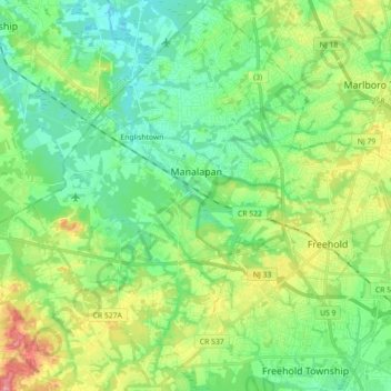
Naam: Topografische kaart Manalapan Township, hoogte, reliëf.
Gemiddelde hoogte: 41 m
Minimale hoogte: 12 m
Maximale hoogte: 104 m