
Topografische kaart Parque Nacional Natural Tatamá
Interactieve kaart
Klik op de kaart om de hoogte weer te geven.
Over deze kaart
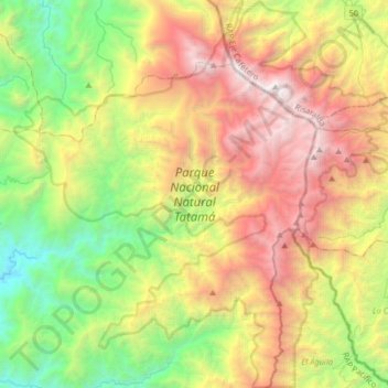
Naam: Topografische kaart Parque Nacional Natural Tatamá, hoogte, reliëf.
Gemiddelde hoogte: 1.788 m
Minimale hoogte: 212 m
Maximale hoogte: 4.079 m