
Topografische kaart Yula
Interactieve kaart
Klik op de kaart om de hoogte weer te geven.
Over deze kaart
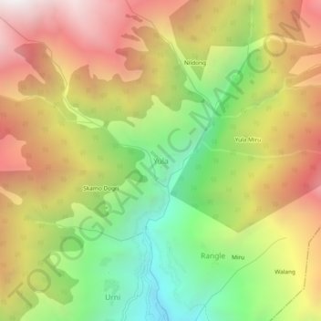
Naam: Topografische kaart Yula, hoogte, reliëf.
Locatie: Yula, Nichar, Kinnaur District, Himachal Pradesh, India (31.52743 78.11700 31.56743 78.15700)
Gemiddelde hoogte: 2.943 m
Minimale hoogte: 1.937 m
Maximale hoogte: 3.975 m