
Topografische kaart Dike
Interactieve kaart
Klik op de kaart om de hoogte weer te geven.
Over deze kaart
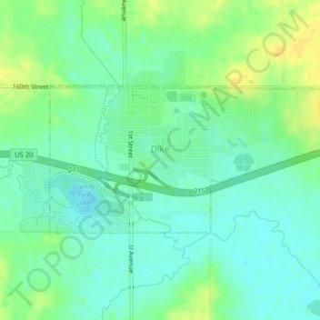
Naam: Topografische kaart Dike, hoogte, reliëf.
Locatie: Dike, Grundy County, Iowa, United States (42.45642 -92.64194 42.46977 -92.60244)
Gemiddelde hoogte: 291 m
Minimale hoogte: 281 m
Maximale hoogte: 305 m
Andere topografische kaarten
Klik op een kaart om zijn topografie, zijn hoogte en zijn reliëf te bekijken.
Grundy Center
United States > Iowa > Grundy County
Grundy Center, Grundy County, Iowa, United States
Gemiddelde hoogte: 306 m
Beaman
United States > Iowa > Grundy County
Beaman, Grundy County, Iowa, United States
Gemiddelde hoogte: 309 m
Wellsburg
United States > Iowa > Grundy County
Wellsburg, Grundy County, Iowa, United States
Gemiddelde hoogte: 327 m
Holland
United States > Iowa > Grundy County
Holland, Grundy County, Iowa, United States
Gemiddelde hoogte: 310 m
Reinbeck
United States > Iowa > Grundy County
Reinbeck, Grundy County, Iowa, 50669, United States
Gemiddelde hoogte: 290 m
Conrad
United States > Iowa > Grundy County
Conrad, Grundy County, Iowa, 50621, United States
Gemiddelde hoogte: 313 m
Stout
United States > Iowa > Grundy County
Stout, Grundy County, Iowa, 50673, United States
Gemiddelde hoogte: 309 m
Morrison
United States > Iowa > Grundy County
Morrison, Grundy County, Iowa, 50657, United States
Gemiddelde hoogte: 295 m