
Topografische kaart Paint Lake Provincial Park
Interactieve kaart
Klik op de kaart om de hoogte weer te geven.
Over deze kaart
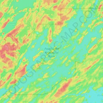
Naam: Topografische kaart Paint Lake Provincial Park, hoogte, reliëf.
Gemiddelde hoogte: 198 m
Minimale hoogte: 179 m
Maximale hoogte: 239 m
Andere topografische kaarten
Klik op een kaart om zijn topografie, zijn hoogte en zijn reliëf te bekijken.
Halfway Lake
Canada > Manitoba > Local Government District of Mystery Lake
Halfway Lake, Local Government District of Mystery Lake, Manitoba, Canada
Gemiddelde hoogte: 225 m
Setting Lake
Canada > Manitoba > Local Government District of Mystery Lake
Setting Lake, Local Government District of Mystery Lake, Manitoba, Canada
Gemiddelde hoogte: 229 m