
Topografische kaart Billington and Langho
Interactieve kaart
Klik op de kaart om de hoogte weer te geven.
Over deze kaart
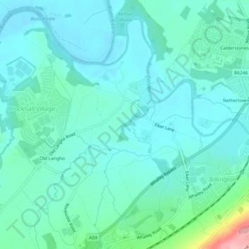
Naam: Topografische kaart Billington and Langho, hoogte, reliëf.
Gemiddelde hoogte: 58 m
Minimale hoogte: 32 m
Maximale hoogte: 187 m
Andere topografische kaarten
Klik op een kaart om zijn topografie, zijn hoogte en zijn reliëf te bekijken.
Old Langho
United Kingdom > England > Lancashire > Ribble Valley > Brockhall Village
Old Langho, Billington and Langho, Brockhall Village, Ribble Valley, Lancashire, England, BB6 8AP, United Kingdom
Gemiddelde hoogte: 74 m