

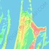
Topografische kaart Giants Castle
Klik op de kaart om de hoogte weer te geven.
Over deze kaart

Naam: Topografische kaart Giants Castle, hoogte, reliëf.
Locatie: Giants Castle, Qikiqtaaluk Region, Nunavut, Canada (72.81459 -86.77753 72.81469 -86.77743)
Gemiddelde hoogte: 314 m
Minimale hoogte: 249 m
Maximale hoogte: 359 m
Andere topografische kaarten
Klik op een kaart om zijn topografie, zijn hoogte en zijn reliëf te bekijken.


Arctic Bay
Canada > Nunavut > Qikiqtaaluk Region
Arctic Bay experiences a tundra climate (Köppen: ET) like most northern Canadian territories at low elevations, with long, very cold winters and short, cool to cold summers. July is the only month with an average low temperature above freezing. Its climate does not differ from the more severe subarctic…
Gemiddelde hoogte: 160 m



Arctic Bay
Canada > Nunavut > Qikiqtaaluk Region
Arctic Bay experiences a tundra climate (Köppen: ET) like most northern Canadian territories at low elevations, with long, very cold winters and short, cool to cold summers. July is the only month with an average low temperature above freezing. Its climate does not differ from the more severe subarctic…
Gemiddelde hoogte: 137 m


