
Topografische kaart Raystown Lake
Interactieve kaart
Klik op de kaart om de hoogte weer te geven.
Raystown Lake
The proposal for the new dam incorporated the ideas of bringing tourism into the area, promoting recreation, and flood control. The actual purpose stated, "The project will provide flood control, recreation, water quality and fish and wildlife enhancement" (U.S. Army Corps of Engineers, 1974). Although tourism and recreation was what was projected as the most important to the public and community, the reason the dam was approved was for flood control. The project was authorized under the general provisions of the Flood Control Act of 1962 (Public Law 87-874, 87th Congress, second session). The dam has a flood storage capacity of 247,900 acre-feet (305,800,000 m3), equivalent to about 5 inches (13 cm) of runoff from the drainage area of 960 square miles (2,500 km2) above the dam, between elevations of 786 and 812 (U.S. Army Corps of Engineers, 1965). "The project would reduce flood stages along the Juniata River at Mount Union, Lewistown, Mifflin, and Newport, Pennsylvania, and to a lesser extent, along the main stem of the Susquehanna River below the mouth of the Juniata River" (U.S. Army Corps of Engineers, 1965).
Over deze kaart
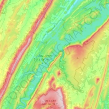
Naam: Topografische kaart Raystown Lake, hoogte, reliëf.
Gemiddelde hoogte: 380 m
Minimale hoogte: 206 m
Maximale hoogte: 712 m
Andere topografische kaarten
Klik op een kaart om zijn topografie, zijn hoogte en zijn reliëf te bekijken.