
Doe een donatie
Rust jezelf uit voor je volgende avontuur:
Als Amazon-partner verdient deze site een commissie op in aanmerking komende aankopen, zonder extra kosten voor jou.
Topografische kaart Battle Mountain
Klik op de kaart om de hoogte weer te geven.
Doe een donatie
Rust jezelf uit voor je volgende avontuur:
Als Amazon-partner verdient deze site een commissie op in aanmerking komende aankopen, zonder extra kosten voor jou.
Battle Mountain
Battle Mountain's climate is cool semi-arid (Köppen climate classification BSk), receiving just enough precipitation to avoid arid classification. Due to aridity and high elevation, the area commonly experiences large diurnal temperature variation, particularly in summer, when it averages almost 45 °F or 25 °C. The monthly daily average temperature ranges from 29.8 °F or −1.2 °C in January to 73.6 °F or 23.1 °C in July. There are, on average, fourteen afternoons of 100 °F or 37.8 °C or hotter maxima, 74 afternoons of 90 °F or 32.2 °C or hotter maxima, eleven afternoons where the high does not rise above freezing, and seven mornings falling to or below 0 °F or −17.8 °C annually; the average window for freezing temperatures is September 16 to May 29. By far the coldest recorded month has been January 1949, with a mean of 4.6 °F (−15.2 °C) and a mean minimum of −12.0 °F (−24.4 °C) – between January 2 and February 3, the temperature did not reach freezing, whereas during the winter of 2011/2012 every single day topped freezing. The hottest month has been July 2013, with a mean of 79.9 °F (26.6 °C) and a mean maximum of 100.1 °F (37.8 °C), although July 2007's maximum was even hotter at 100.8 °F (38.2 °C).
Doe een donatie
Rust jezelf uit voor je volgende avontuur:
Als Amazon-partner verdient deze site een commissie op in aanmerking komende aankopen, zonder extra kosten voor jou.
Over deze kaart
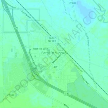
Naam: Topografische kaart Battle Mountain, hoogte, reliëf.
Locatie: Battle Mountain, Lander County, Nevada, United States (40.62577 -116.95528 40.65724 -116.92624)
Gemiddelde hoogte: 1.376 m
Minimale hoogte: 1.372 m
Maximale hoogte: 1.380 m
Doe een donatie
Rust jezelf uit voor je volgende avontuur:
Als Amazon-partner verdient deze site een commissie op in aanmerking komende aankopen, zonder extra kosten voor jou.
Andere topografische kaarten
Klik op een kaart om zijn topografie, zijn hoogte en zijn reliëf te bekijken.
Austin
United States > Nevada > Lander County
Austin is an unincorporated small town in, and former county seat of, Lander County, Nevada, United States. In 2020, the census-designated place of Austin had a population of 167. It is located on the western slopes of the Toiyabe Range at an elevation of 6,575 feet (2,004 m). U.S. Route 50 passes through the…
Gemiddelde hoogte: 2.061 m
Austin
United States > Nevada > Lander County
Austin is an unincorporated small town in, and former county seat of, Lander County, Nevada, United States. In 2020, the census-designated place of Austin had a population of 167. It is located on the western slopes of the Toiyabe Range at an elevation of 6,575 feet (2,004 m). U.S. Route 50 passes through the…
Gemiddelde hoogte: 2.076 m