
Topografische kaart Steeple Barton
Interactieve kaart
Klik op de kaart om de hoogte weer te geven.
Over deze kaart
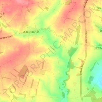
Naam: Topografische kaart Steeple Barton, hoogte, reliëf.
Gemiddelde hoogte: 129 m
Minimale hoogte: 77 m
Maximale hoogte: 165 m
Andere topografische kaarten
Klik op een kaart om zijn topografie, zijn hoogte en zijn reliëf te bekijken.
Cote
United Kingdom > England > Oxfordshire > West Oxfordshire > Aston
Cote, Aston, Cote, Shifford and Chimney, Aston, West Oxfordshire, Oxfordshire, England, OX18 2EG, United Kingdom
Gemiddelde hoogte: 67 m
Glympton
United Kingdom > England > Oxfordshire > West Oxfordshire
Glympton, West Oxfordshire, Oxfordshire, England, United Kingdom
Gemiddelde hoogte: 123 m
Finstock
United Kingdom > England > Oxfordshire > West Oxfordshire
Finstock, West Oxfordshire, Oxfordshire, England, United Kingdom
Gemiddelde hoogte: 127 m
Wootton
United Kingdom > England > Oxfordshire > West Oxfordshire
Wootton, West Oxfordshire, Oxfordshire, England, United Kingdom
Gemiddelde hoogte: 112 m
Idbury
United Kingdom > England > Oxfordshire > West Oxfordshire
Idbury, West Oxfordshire, Oxfordshire, England, United Kingdom
Gemiddelde hoogte: 147 m
Great Park
United Kingdom > England > Oxfordshire > West Oxfordshire > Long Hanborough
Great Park, Blenheim, Long Hanborough, West Oxfordshire, Oxfordshire, England, United Kingdom
Gemiddelde hoogte: 94 m
Spelsbury
United Kingdom > England > Oxfordshire > West Oxfordshire
Spelsbury, West Oxfordshire, Oxfordshire, England, United Kingdom
Gemiddelde hoogte: 150 m
Rollright
United Kingdom > England > Oxfordshire > West Oxfordshire
Rollright, West Oxfordshire, Oxfordshire, England, United Kingdom
Gemiddelde hoogte: 186 m
Hailey
United Kingdom > England > Oxfordshire > West Oxfordshire
Hailey, West Oxfordshire, Oxfordshire, England, OX29 9UG, United Kingdom
Gemiddelde hoogte: 112 m
Chilson
United Kingdom > England > Oxfordshire > West Oxfordshire
Chilson, West Oxfordshire, Oxfordshire, England, United Kingdom
Gemiddelde hoogte: 132 m
Broughton Poggs
United Kingdom > England > Oxfordshire > West Oxfordshire
Broughton Poggs, West Oxfordshire, Oxfordshire, England, GL7 3JH, United Kingdom
Gemiddelde hoogte: 90 m
Fawler
United Kingdom > England > Oxfordshire > West Oxfordshire
Fawler, West Oxfordshire, Oxfordshire, England, United Kingdom
Gemiddelde hoogte: 117 m
Shipton-under-Wychwood
United Kingdom > England > Oxfordshire > West Oxfordshire
Shipton-under-Wychwood, West Oxfordshire, Oxfordshire, England, OX7 6DE, United Kingdom
Gemiddelde hoogte: 131 m
Kelmscott
United Kingdom > England > Oxfordshire > West Oxfordshire
Kelmscott, West Oxfordshire, Oxfordshire, England, United Kingdom
Gemiddelde hoogte: 73 m
Little Tew
United Kingdom > England > Oxfordshire > West Oxfordshire
Little Tew, West Oxfordshire, Oxfordshire, England, United Kingdom
Gemiddelde hoogte: 184 m
Chadlington
United Kingdom > England > Oxfordshire > West Oxfordshire
Chadlington, West Oxfordshire, Oxfordshire, England, United Kingdom
Gemiddelde hoogte: 161 m
Witney
United Kingdom > England > Oxfordshire > West Oxfordshire
Witney, West Oxfordshire, Oxfordshire, England, United Kingdom
Gemiddelde hoogte: 92 m
Over Norton
United Kingdom > England > Oxfordshire > West Oxfordshire
Over Norton, West Oxfordshire, Oxfordshire, England, United Kingdom
Gemiddelde hoogte: 195 m
Carterton
United Kingdom > England > Oxfordshire > West Oxfordshire
Carterton, West Oxfordshire, Oxfordshire, England, United Kingdom
Gemiddelde hoogte: 95 m
Chipping Norton
United Kingdom > England > Oxfordshire > West Oxfordshire
Chipping Norton, West Oxfordshire, Oxfordshire, England, United Kingdom
Gemiddelde hoogte: 194 m
Westwell
United Kingdom > England > Oxfordshire > West Oxfordshire
Westwell, West Oxfordshire, Oxfordshire, England, United Kingdom
Gemiddelde hoogte: 138 m
Great Rollright
United Kingdom > England > Oxfordshire > West Oxfordshire
Great Rollright, West Oxfordshire, Oxfordshire, England, OX7 5RH, United Kingdom
Gemiddelde hoogte: 193 m
Bladon
United Kingdom > England > Oxfordshire > West Oxfordshire > Bladon
Bladon, West Oxfordshire, Oxfordshire, England, United Kingdom
Gemiddelde hoogte: 85 m
Kingham
United Kingdom > England > Oxfordshire > West Oxfordshire
Kingham, West Oxfordshire, Oxfordshire, England, United Kingdom
Gemiddelde hoogte: 130 m
Combe
United Kingdom > England > Oxfordshire > West Oxfordshire
Combe, West Oxfordshire, Oxfordshire, England, United Kingdom
Gemiddelde hoogte: 106 m
South Leigh
United Kingdom > England > Oxfordshire > West Oxfordshire > South Leigh
South Leigh, West Oxfordshire, Oxfordshire, England, United Kingdom
Gemiddelde hoogte: 80 m
Tackley
United Kingdom > England > Oxfordshire > West Oxfordshire
Tackley, West Oxfordshire, Oxfordshire, England, United Kingdom
Gemiddelde hoogte: 94 m
Little Faringdon
United Kingdom > England > Oxfordshire > West Oxfordshire > Little Faringdon
Little Faringdon, West Oxfordshire, Oxfordshire, South East England, England, United Kingdom
Gemiddelde hoogte: 80 m
Lyneham
United Kingdom > England > Oxfordshire > West Oxfordshire > Lyneham
Lyneham, West Oxfordshire, Oxfordshire, England, United Kingdom
Gemiddelde hoogte: 130 m
Bampton
United Kingdom > England > Oxfordshire > West Oxfordshire > Bampton
Bampton, West Oxfordshire, Oxfordshire, England, United Kingdom
Gemiddelde hoogte: 72 m
Heythrop
United Kingdom > England > Oxfordshire > West Oxfordshire > Heythrop
Heythrop, West Oxfordshire, Oxfordshire, South East England, England, United Kingdom
Gemiddelde hoogte: 195 m
Broughton Poggs
United Kingdom > England > Oxfordshire > West Oxfordshire
Langford, Broughton Poggs, West Oxfordshire, Oxfordshire, England, United Kingdom
Gemiddelde hoogte: 80 m
Church Hanborough
United Kingdom > England > Oxfordshire > West Oxfordshire > Church Hanborough
Church Hanborough, West Oxfordshire, Oxfordshire, South East England, England, OX29 8AB, United Kingdom
Gemiddelde hoogte: 85 m
Stanton Harcourt
United Kingdom > England > Oxfordshire > West Oxfordshire > Stanton Harcourt
Stanton Harcourt, West Oxfordshire, Oxfordshire, England, United Kingdom
Gemiddelde hoogte: 67 m
Eynsham
United Kingdom > England > Oxfordshire > West Oxfordshire
Eynsham, West Oxfordshire, Oxfordshire, England, United Kingdom
Gemiddelde hoogte: 75 m
Brize Norton
United Kingdom > England > Oxfordshire > West Oxfordshire
Brize Norton, West Oxfordshire, Oxfordshire, England, United Kingdom
Gemiddelde hoogte: 97 m
Ramsden
United Kingdom > England > Oxfordshire > West Oxfordshire
Ramsden, West Oxfordshire, Oxfordshire, England, United Kingdom
Gemiddelde hoogte: 136 m
Woodstock
United Kingdom > England > Oxfordshire > West Oxfordshire > Woodstock
Woodstock, West Oxfordshire, Oxfordshire, South East England, England, United Kingdom
Gemiddelde hoogte: 96 m
Burford
United Kingdom > England > Oxfordshire > West Oxfordshire > Fulbrook
Burford, Fulbrook, West Oxfordshire, Oxfordshire, England, United Kingdom
Gemiddelde hoogte: 129 m
Minster Lovell
United Kingdom > England > Oxfordshire > West Oxfordshire > Minster Lovell
Minster Lovell, West Oxfordshire, Oxfordshire, England, United Kingdom
Gemiddelde hoogte: 112 m
Swerford
United Kingdom > England > Oxfordshire > West Oxfordshire
Swerford, West Oxfordshire, Oxfordshire, England, United Kingdom
Gemiddelde hoogte: 164 m
Standlake
United Kingdom > England > Oxfordshire > West Oxfordshire
Standlake, West Oxfordshire, Oxfordshire, England, United Kingdom
Gemiddelde hoogte: 67 m
Ducklington
United Kingdom > England > Oxfordshire > West Oxfordshire > Ducklington
Ducklington, West Oxfordshire, Oxfordshire, South East England, England, United Kingdom
Gemiddelde hoogte: 80 m
Curbridge
United Kingdom > England > Oxfordshire > West Oxfordshire
Curbridge, West Oxfordshire, Oxfordshire, England, United Kingdom
Gemiddelde hoogte: 94 m
Charlbury
United Kingdom > England > Oxfordshire > West Oxfordshire > Charlbury
Charlbury, West Oxfordshire, Oxfordshire, England, United Kingdom
Gemiddelde hoogte: 132 m
Cassington
United Kingdom > England > Oxfordshire > West Oxfordshire
Cassington, West Oxfordshire, Oxfordshire, England, United Kingdom
Gemiddelde hoogte: 72 m
North Leigh
United Kingdom > England > Oxfordshire > West Oxfordshire
North Leigh, West Oxfordshire, Oxfordshire, England, United Kingdom
Gemiddelde hoogte: 108 m
Clanfield
United Kingdom > England > Oxfordshire > West Oxfordshire
Clanfield, West Oxfordshire, Oxfordshire, England, United Kingdom
Gemiddelde hoogte: 71 m
Taynton
United Kingdom > England > Oxfordshire > West Oxfordshire
Taynton, West Oxfordshire, Oxfordshire, England, United Kingdom
Gemiddelde hoogte: 152 m
Cornwell
United Kingdom > England > Oxfordshire > West Oxfordshire
Cornwell, West Oxfordshire, Oxfordshire, England, United Kingdom
Gemiddelde hoogte: 179 m