
Topografische kaart Darreh Shahr
Interactieve kaart
Klik op de kaart om de hoogte weer te geven.
Darreh Shahr
The elevation of the town varies from 635 m (2,083 ft) in the northeast to 695 m (2,280 ft) in the southwest areas which are closer to the mountains.
Over deze kaart
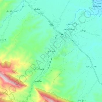
Naam: Topografische kaart Darreh Shahr, hoogte, reliëf.
Gemiddelde hoogte: 734 m
Minimale hoogte: 554 m
Maximale hoogte: 1.324 m