
Topografische kaart Багратионовск
Interactieve kaart
Klik op de kaart om de hoogte weer te geven.
Over deze kaart
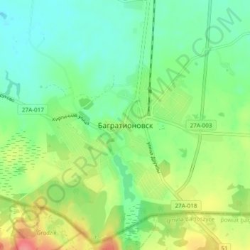
Naam: Topografische kaart Багратионовск, hoogte, reliëf.
Gemiddelde hoogte: 74 m
Minimale hoogte: 49 m
Maximale hoogte: 121 m
Andere topografische kaarten
Klik op een kaart om zijn topografie, zijn hoogte en zijn reliëf te bekijken.
Maloye Ozornoye
Russia > Kaliningrad > Bagrationovsky District
Maloye Ozornoye, Bagrationovsky District, Kaliningrad, Northwestern Federal District, 238420, Russia
Gemiddelde hoogte: 67 m
Bolshoye Ozornoye
Russia > Kaliningrad > Bagrationovsky District
Bolshoye Ozornoye, Bagrationovsky District, Kaliningrad, Northwestern Federal District, 238420, Russia
Gemiddelde hoogte: 73 m