Topografische kaart Mahad
Klik op de kaart om de hoogte weer te geven.
Mahad
Several disasters like floods and landslides have continuously devastated markets and old houses, specifically classic Konkani-styled architecture, causing great loss of life. This is primarily due to lower elevation of the city compared to surrounding areas and being surrounded by rivers on all sides, making the city like a triangular island. Also, Konkan, receives predominantly very heavy rainfall in comparison to rest of Maharashtra.
Over deze kaart
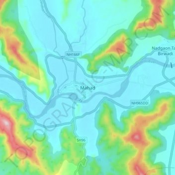
Naam: Topografische kaart Mahad, hoogte, reliëf.
Locatie: Mahad, Mahad Taluka, Raigad, Maharashtra, 402300, India (18.04075 73.38438 18.12075 73.46438)
Gemiddelde hoogte: 75 m
Minimale hoogte: 0 m
Maximale hoogte: 366 m
Andere topografische kaarten
Klik op een kaart om zijn topografie, zijn hoogte en zijn reliëf te bekijken.