
Topografische kaart Buchałów
Interactieve kaart
Klik op de kaart om de hoogte weer te geven.
Over deze kaart
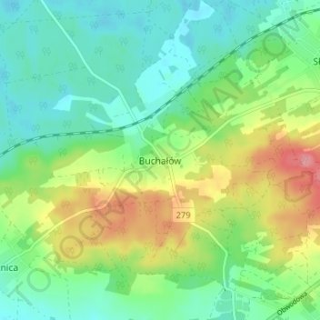
Naam: Topografische kaart Buchałów, hoogte, reliëf.
Gemiddelde hoogte: 121 m
Minimale hoogte: 90 m
Maximale hoogte: 183 m
Andere topografische kaarten
Klik op een kaart om zijn topografie, zijn hoogte en zijn reliëf te bekijken.
Cigacice
Poland > Lubusz Voivodeship > Zielona Góra County
Cigacice, gmina Sulechów, Zielona Góra County, Lubusz Voivodeship, 66-131, Poland
Gemiddelde hoogte: 67 m